Part 3 · Settlement
Spanish Trails & Fur Trappers
The era of exploration and trade preceding Euro-American settlement: ancient Ute commerce routes, the Old Spanish Trail, Mexican pack-train operators, and American mountain men in Emery County canyon country.
Ch14 — Spanish Trails & Fur Trappers
Long before wagon roads or rail lines crossed the Colorado Plateau, a network of footpaths threaded through Emery County’s canyon country. Indigenous traders, Spanish missionaries, Mexican pack-train operators, and American mountain men each left their mark on the landscape — sometimes literally, in the form of carved inscriptions on sandstone walls. This chapter traces the era of exploration and trade that preceded permanent Euro-American settlement, from the ancient Ute commerce routes through the opening and eventual decline of the Old Spanish Trail, with particular attention to the trail corridors, river crossings, and fur-trapping grounds that touched what is now Emery County.
14.1 Pre-Contact Footpaths & Ute Trade Networks
The Ute peoples who inhabited the eastern Great Basin and western Colorado Plateau maintained trade relationships that stretched from the Rio Grande pueblos to the northern Plains. Archaeological evidence and early European accounts describe a web of trails crossing Castle Valley and penetrating every adjacent canyon — paths worn by generations of hunters, seasonal migrants, and traders carrying obsidian, turquoise, shells, hides, and dried foodstuffs.
Trade fairs known as rescates, held annually at Taos, Santa Clara, Pecos, and other New Mexico pueblos, served as the primary exchange points where Ute bands met Pueblo, Navajo, and later Spanish traders. Ute groups brought mountain products — meat, hides, and minerals — and returned with corn, woven blankets, and ceramic goods. After the acquisition of horses, probably between the 1640s and early 1700s, Ute bands transformed into formidable mounted traders and raiders, establishing horse-trade corridors that connected the Spanish Southwest to the northern Plains. These corridors followed natural topographic routes through the San Rafael drainage, across the Wasatch Plateau, and along the Green River — paths that later European travelers would adopt and rename.
The significance of these Indigenous networks cannot be overstated. When the Domínguez–Escalante expedition entered the region in 1776, the padres relied on Ute guides who knew trails that Europeans had never seen. When Antonio Armijo’s pack train opened the Old Spanish Trail in 1829, his route through Castle Valley followed paths already ancient. The exploration era was, in many respects, a story of outsiders learning routes that Ute peoples had traveled for centuries (Utah Division of Indian Affairs, 2020; community.utah.gov).
14.2 Domínguez–Escalante Expedition (1776)
On July 29, 1776 — the same summer that American colonists declared independence three thousand miles to the east — a party of roughly twelve men departed Santa Fe under the leadership of Franciscan friars Francisco Atanasio Domínguez and Silvestre Vélez de Escalante. Their mission was to find a practical overland route from New Mexico to the recently established Spanish missions on the California coast. Accompanying them was Bernardo de Miera y Pacheco, a retired military engineer who would serve as the expedition’s cartographer and produce the first European maps of the Utah region.
The party traveled north through western Colorado, entering present-day Utah near Dinosaur National Monument around September 11, 1776. They crossed the Wasatch Mountains through Diamond Fork and Spanish Fork canyons and reached Utah Valley by September 22. After consulting with local Timpanogos Ute leaders about the route westward, the expedition turned south rather than pressing on to California, deterred by early snow and dwindling supplies.
The return journey brought the expedition closer to what is now Emery County. The party crossed the Colorado River near present-day Moab and traversed the rugged canyon country of southeastern Utah before eventually reaching Santa Fe on January 2, 1777, having covered approximately two thousand miles in just over five months. While the expedition did not pass directly through the boundaries of modern Emery County, it established critical geographic knowledge of the surrounding terrain — the Green River drainage, the San Rafael Swell, and the routes connecting the Colorado Plateau to the Wasatch front — that would guide subsequent travelers (BYU History, 2023; NPS Dinosaur National Monument).
The expedition’s most lasting contribution was Miera y Pacheco’s map, drawn at Santa Fe in 1777. It was the first systematic cartographic rendering of the interior Great Basin and Colorado Plateau, recording latitudes at multiple points — the first geodetic measurements ever taken in the region. Miera’s map was studied by prominent geographic scholars — most notably Alexander von Humboldt, who consulted Spanish colonial cartography in Mexico City around 1803 — and it likely influenced American geographic knowledge of the interior West, though the precise chain of transmission from Miera through Humboldt to Thomas Jefferson and subsequent American mapmakers requires further documentary verification (collections.lib.utah.edu; ilovehistory.utah.gov).
14.3 Old Spanish Trail (1829–1848)
For half a century after Domínguez and Escalante turned back, the route between Santa Fe and California remained unlinked by any regular trail. The terrain was simply too formidable: deep canyons cut by the San Juan, Colorado, Green, Dirty Devil, and San Rafael rivers forced any practical route into long detours through high desert. It was not until 1829 that Antonio Armijo, a Mexican trader, successfully led a commercial pack-mule caravan from Santa Fe to Los Angeles, opening what became known as the Old Spanish Trail.
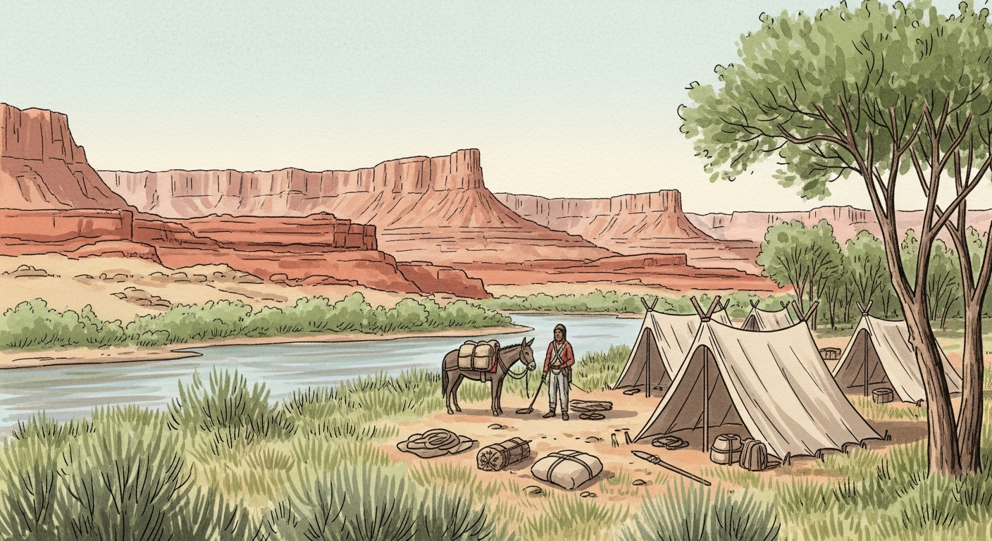
The trail’s route through Emery County is among its most clearly documented segments. After crossing the Green River near the site of the present-day town of Green River, the trail skirted the northern edge of the San Rafael Swell — the northernmost reach of the entire route. From the river crossing, caravans passed along the south side of Cedar Mountain, traversed Buckhorn Flat, and continued past the Red Seeps to Huntington Creek, fording the stream approximately one mile below where the modern bridge stands. The route then continued to Cottonwood Creek and crossed Ferron Creek at the site of Molen. Passing through Rochester Flats about a mile east of present-day Moore, the trail crossed Muddy Creek roughly two miles east of the town of Emery before ascending Salina Canyon toward the Sevier Valley and points west (Utah History to Go; NPS Old Spanish Trail Resource Document, Emery County segment).
For nearly two decades, this corridor served as the primary commercial link between the two Mexican provinces. The dominant trade was livestock: California horses driven eastward to Santa Fe, where they commanded premium prices. Westbound caravans carried New Mexican woolens, blankets, and other manufactured goods. At its peak, a single caravan might include dozens of traders and hundreds of animals, strung out along the narrow trail for miles. The Green River crossing was a critical chokepoint — the river was treacherous, and the surrounding area served as a staging ground where caravans regrouped before the long push across Castle Valley.
The trail’s active period ended with the Mexican–American War and the Treaty of Guadalupe Hidalgo in 1848, which transferred the entire region to the United States. By that time, the California Gold Rush was about to redirect western migration onto entirely different routes. The Old Spanish Trail, which had never been suitable for wagons, fell into disuse (Old Spanish Trail Association; historytogo.utah.gov).
14.4 Mexican Governance & the Fur Frontier
From 1821 to 1848, the land that would become Emery County belonged — at least on paper — to the Republic of Mexico, part of the vast province of Santa Fe de Nuevo México. In practice, Mexican authority over this remote interior was negligible. No Mexican garrison, mission, or administrative outpost existed anywhere near the Green River or Castle Valley. Governance was exercised, to the extent it existed at all, through the licensing of trappers and traders operating out of Santa Fe and Taos.
The Mexican government issued trapping licenses, called guías, to regulate the fur trade. Naturalized Mexican citizens could obtain permits directly; foreign-born trappers needed a local intermediary. Enforcement was erratic. In 1826, the alcalde of Taos confiscated the beaver pelts of Sylvestre Pratte and François Robidoux, even though both men held permits issued by the governor. When the traders protested, Santa Fe officials ordered the pelts returned — an episode that illustrated both the existence of a regulatory framework and its fundamental weakness (Tollefson, 2018; historytogo.utah.gov/traders).
After the 1827 rendezvous at Bear Lake in northern Utah, Mexican officials lodged formal protests against American trappers operating on what Mexico considered its sovereign territory. The protests went nowhere. The 42nd parallel — the nominal boundary between Mexican and American claims — was too vaguely surveyed and too distant from any Mexican military force to be enforced. American and French-American mountain men operated with near-total freedom throughout the Green River drainage and the canyonlands to its south, treating the region as an open-access commons for beaver trapping (Utah History Encyclopedia; historytogo.utah.gov).
14.5 Mountain Men Era (1820s–1840s)
The opening of the Santa Fe Trail from Missouri to Santa Fe in 1821 unleashed a wave of Anglo-Celtic and French-American fur trappers into the intermountain West. Within a few years, trapping brigades were working every major watercourse in present-day Utah, and the Green River — which forms the eastern boundary of Emery County for much of its course — became one of the most intensively trapped drainages in the region.
The key figures of this era — Étienne Provost, Antoine Robidoux, Denis Julien, Jim Bridger, and Kit Carson — are better documented in northern Utah, where the annual fur-trade rendezvous drew hundreds of trappers, traders, and Indigenous participants to Bear Lake, Cache Valley, and the upper Green River. But the fur brigades of Provost, Robidoux, and William Becknell repeatedly worked the middle and lower Green River through the 1820s, and smaller trapping parties undoubtedly penetrated the San Rafael drainage, Muddy Creek, and the tributary streams of Castle Valley. The terrain was less productive than the beaver-rich northern ranges, but it offered trapping opportunities along perennial streams flowing off the Wasatch Plateau.
Denis Julien, a shadowy French-American trapper associated with the Robidoux network, is known primarily through the inscriptions he carved on canyon walls along the Green and Colorado rivers during the 1830s. His dated carvings — inscriptions dating to the 1830s (and possibly the late 1820s), among the earliest European-authored marks in the canyonlands — testify to the presence of individual trappers in the deep river corridors that border and bisect Emery County. Whether Julien operated within the modern county boundaries remains a matter of ongoing research, but his movements through the Green River canyon system place him in the immediate vicinity (Wikipedia: Denis Julien; gjsentinel.com).
The mountain-man era was brief. By 1828, trapping activity in Utah had declined considerably as beaver populations crashed from overharvesting. The annual rendezvous system, which had served as the economic engine of the fur trade since 1825, held its last official gathering in summer 1840 at Horse Creek (in present-day Wyoming). Shifting fashion — the European hat market’s turn from beaver felt to silk — collapsed demand, and the remaining trappers either drifted into other occupations or became guides for the emigrant wagon trains that would soon transform the West (Utah History Encyclopedia; historytogo.utah.gov).
14.6 Robidoux & the Uintah Basin Trading Posts
Antoine Robidoux, born in 1794 to a prominent French-Canadian trading family in St. Louis, became the dominant commercial figure on the southern fur frontier. By the 1820s, he was operating out of Santa Fe and Taos, developing trade routes through the intermountain corridors of northern New Mexico and eastern Utah.
In 1828, Denis Julien, a trapper named Archambeaux, and William “Toopchee” Reed established a small trading post near a spring south of present-day Whiterocks, Utah, in the Uintah Basin. They brought the first manufactured goods — butcher knives, coffee, cloth — to the local Ute bands and traded them for furs. Four years later, Robidoux purchased the Reed post and rebuilt it on a much larger scale as Fort Robidoux, also known as Fort Uintah or Fort Winty, at the confluence of the Uinta and Whiterocks rivers.
Fort Robidoux became the most important trading post in the southern intermountain region. It was visited by many of the era’s notable figures, including Marcus Whitman, Miles Goodyear, and Kit Carson. Robidoux dominated the Uinta Basin fur trade, competing successfully against Fort Davy Crockett in Brown’s Hole on the Green River, as well as against the American Fur Company and the Hudson’s Bay Company. His network of trappers and traders ranged across a vast territory that included the Green River drainage bordering Emery County.
The fort’s destruction by a Ute attack in 1844 effectively marked the end of the organized fur trade in the region. The attack reflected growing tensions as Indigenous communities experienced the cumulative effects of resource depletion, cultural disruption, and the unfavorable terms of trade that had characterized the fur-trade era (Utah History Encyclopedia; historytogo.utah.gov/antoine-robidoux).
14.7 Beaver, Buffalo & Market Demand
The fur trade in Utah was almost entirely driven by demand for beaver pelts, which were processed into the felt used for fashionable hats in Europe and the eastern United States. For a compressed period from roughly 1825 to 1840, this demand drew trapping expeditions into every stream drainage in northern and central Utah, including the Green River system that borders Emery County.
The intensity of harvest was staggering. The Hudson’s Bay Company, alarmed by the encroachment of American trappers into the Oregon Country, adopted a deliberate policy of environmental destruction. Under orders from Governor George Simpson, Snake River trapping brigades were instructed to trap every beaver they could find, creating a “fur desert” that would discourage American competitors from advancing farther north. While this policy was focused on the Snake River region, it contributed to a regional depletion that affected streams throughout Utah. By 1828, trapping activity had declined sharply simply because there were too few beaver left to sustain commercial operations (Utah History Encyclopedia; UCN, 2023).
The ecological consequences extended far beyond the beaver themselves. Beaver dams create and maintain riparian wetlands, moderate stream flow, trap sediment, and support diverse plant and animal communities. The removal of beaver from Utah’s waterways triggered a cascade of environmental effects: stream channels incised and narrowed, wetlands dried, water tables dropped, and the biological productivity of riparian corridors declined. In a landscape as arid as east-central Utah, where perennial streams are the lifeline of the ecosystem, the loss of beaver engineering was particularly consequential (Sawtooth Society; uen.org/wildlife_management).
The market that had driven this destruction collapsed almost as quickly as it had arisen. By the early 1840s, European fashion shifted from beaver-felt hats to silk, and the price of beaver pelts plummeted. The mountain men who had roamed the Green River country found their livelihood gone. Many became guides for emigrant parties or drifted into ranching and farming — precursors of the permanent settlement that would follow within a generation.
14.8 Cross-Cultural Encounters & Conflict
The exploration and fur-trade era brought together peoples of vastly different cultures under conditions that were often exploitative and sometimes violent. Fur trappers depended on Indigenous knowledge — Ute guides led the Domínguez–Escalante expedition, and local bands provided geographic intelligence that informed every subsequent European route through the region. In return, trappers offered manufactured goods: metal tools, textiles, firearms, and alcohol. The terms of exchange were rarely equitable, and the introduction of alcohol in particular caused lasting social damage.
A darker aspect of the Old Spanish Trail was the slave trade. Ute and Navajo raiding parties captured Paiute women and children from the weaker bands of the southern Great Basin and sold them to New Mexican traders at trail stops and at the Santa Fe markets. This traffic, documented by contemporary observers and later historians, was a significant component of the trail’s commerce and a source of profound suffering for the peoples caught in its path. The practice continued throughout the active period of the trail and was not effectively suppressed until after American territorial governance was established in the 1850s (Old Spanish Trail Association; historytogo.utah.gov).
Tensions between Euro-American traders and Indigenous communities escalated as the fur trade depleted the animal populations on which Native economies depended. The Ute attack on Fort Robidoux in 1844 was one expression of this growing conflict. As beaver and other game animals vanished from streams and meadows, the material basis for the trade relationship eroded, and the presence of outsiders shifted from a source of desirable goods to a threat to survival.
14.9 Cartography & Trail-Blazing Technology
The exploration era produced the first European cartographic record of the Emery County region. Bernardo de Miera y Pacheco, the military engineer who accompanied Domínguez and Escalante, was described by historians as perhaps the most prolific and important cartographer of New Spain. During the 1776 expedition, he observed latitudes at numerous points along the route — the first systematic geodetic measurements ever taken in the vast area now comprising Colorado and Utah.
Miera’s map, drawn at Santa Fe in 1777, depicted the interior Great Basin and Colorado Plateau with a level of detail that remained unsurpassed for decades. When Alexander von Humboldt examined Spanish colonial maps in Mexico City around 1803, he incorporated their information into his own celebrated maps of New Spain; the precise path by which Miera’s geographic data reached Thomas Jefferson and U.S. mapmakers remains a subject of active scholarship, but Humboldt’s own cartographic work is widely understood to have been a key intermediary. American mapmakers copied and adapted Miera’s work, and his geographic framework influenced the route planning for subsequent expeditions, including John C. Frémont’s surveys of the 1840s (collections.lib.utah.edu; ilovehistory.utah.gov).
The technology of trail-blazing in this era was deceptively simple: compass bearings, astrolabe readings for latitude, dead reckoning between landmarks, and the accumulated knowledge of guides who had traveled the terrain before. Pack-mule logistics governed the practical limits of travel — a loaded mule could cover perhaps fifteen to twenty miles per day over rough terrain, and water sources dictated the spacing of camps. The Old Spanish Trail’s route through Emery County, threading between canyon rims and crossing streams at specific fords, reflects these logistical constraints as much as any grand strategic vision.
14.10 Legacy on Modern Highways & Backroads
The routes pioneered by Spanish missionaries, Mexican traders, and American mountain men left a lasting imprint on Emery County’s transportation geography. The Old Spanish Trail’s corridor through Castle Valley roughly parallels the modern Highway 10 alignment and portions of Interstate 70. The Green River crossing at the modern town of Green River remains, as it was in the 1830s, the principal point where east-west travel intersects the river.
Buckhorn Flat, traversed by Old Spanish Trail caravans, is today accessible via the Buckhorn Draw Road, a county road that offers visitors a chance to travel terrain little changed since the 1840s. Rochester Flats, where the trail passed a mile east of present-day Moore, retains its open desert character. The trail’s influence echoes in local road and place names throughout the county.
The National Park Service designated the Old Spanish Trail as the fifteenth National Historic Trail in December 2002, recognizing its significance to the nation’s westward expansion. In Utah, the NPS identified twenty-one high-potential sites for public interpretation, and the Green River crossing in Emery County is among them. The Old Spanish Trail Heritage Loop, comprising segments of Cottonwood and Lost Spring washes, offers visitors a tangible connection to the historic route (NPS; BLM; expeditionutah.com).
14.11 Environmental Footprint of the Fur Trade
The fur trade’s environmental impact on Emery County’s landscape, while difficult to quantify precisely, was almost certainly significant. The near-total removal of beaver from the Green River and its tributaries during the 1820s and 1830s eliminated a keystone species whose dam-building activity had shaped riparian ecosystems for millennia. Without beaver dams to slow water flow, trap sediment, and maintain wetland habitat, stream channels narrowed and incised, water tables fell, and the biological productivity of streamside corridors declined.
The pack-mule caravans that used the Old Spanish Trail also left physical traces: compacted soil along the trail corridor, erosion at river crossings and steep grades, and the introduction of non-native plant species through seeds carried in cargo, animal feed, and on the hooves of livestock. Herds of California horses driven eastward grazed the sparse desert vegetation along the route, contributing to soil disturbance in an already fragile environment.
In the twentieth and twenty-first centuries, beaver reintroduction efforts across Utah have begun to restore some of the riparian function lost during the fur-trade era. These programs, supported by state wildlife agencies and conservation organizations, recognize the beaver’s role as an ecosystem engineer — a role that was temporarily suspended by the market-driven harvest of the 1820s–1840s (uen.org/wildlife_management; Sawtooth Society).
14.12 Preservation & Public History
Efforts to preserve and interpret the exploration and fur-trade heritage of Emery County began in earnest in the early to mid-1990s, when the Emery County Historical Society placed trail markers in the Green River area identifying segments of the Old Spanish Trail. These markers, among the earliest physical commemorations of the trail in Utah, reflected growing public interest in the region’s pre-settlement history.
The congressional designation of the Old Spanish National Historic Trail in 2002 elevated the trail’s status and brought federal resources to bear on preservation and interpretation. The National Park Service and the Bureau of Land Management now jointly manage trail segments on public lands in Emery County, and the Old Spanish Trail Association (OSTA) conducts ongoing research, mapping, and signage projects. Steven K. Madsen’s extensive photographic and archival research, published through the Utah Historical Society, has been instrumental in documenting surviving trail traces and identifying sites for interpretation.
Visitor opportunities in Emery County include the Green River crossing area, Buckhorn Flat, and the Rochester Flats vicinity — all places where the historic trail can be experienced in a landscape that retains much of its original character. The NPS Heritage Loop trail in the Cottonwood and Lost Spring wash area provides a designated interpretive route. For the modern visitor willing to travel unpaved roads and walk desert terrain, the Old Spanish Trail offers a direct, physical connection to the era when Emery County stood at the crossroads of Spanish, Mexican, and American ambitions in the West.
Sources
- BYU History Department. “Dominguez and Escalante Expedition.” history.byu.edu.
- Community Engagement, Utah Division. “Pre-European Settlement, Crossroads, and the Idea of Home.” community.utah.gov.
- Expedition Utah. “The Old Spanish Trail.” expeditionutah.com.
- Grand Junction Sentinel. “Mysterious fur trader left his mark in Utah and Colorado.” gjsentinel.com, 2023.
- I Love History (Utah). “1776: The Domínguez-Escalante Expedition.” ilovehistory.utah.gov.
- Madsen, Steven K. “In Search of the Spanish Trail: Santa Fe to Los Angeles, 1829–1948.” Utah Historical Society. history.utah.gov.
- National Park Service. “Old Spanish National Historic Trail — Utah.” nps.gov/olsp.
- National Park Service. “Old Spanish Trail Heritage Loop.” nps.gov/places.
- National Park Service. “The Dominguez and Escalante Expedition.” Dinosaur National Monument. nps.gov/dino.
- NPS History. “The Old Spanish National Historic Trail: Resource Document, Emery County.” npshistory.com/publications/olsp/rds/emery-ut.pdf.
- Old Spanish Trail Association. “History.” oldspanishtrail.org.
- Sawtooth Society. “Furry Banknotes: A History of Fur Trapping and its Environmental Impact.” discoversawtooth.org.
- Tollefson, Loretta Miles. “There’s Always a Way — Fur Trapping Under Mexican Law.” 2018.
- University College of the North. “The Environmental Impact of Over-Harvesting in the Fur Trade.” ucn.ca, 2023.
- University of Utah Marriott Library. “Plano geografico — Bernardo de Miera y Pacheco.” collections.lib.utah.edu.
- U.S. Bureau of Land Management. “Old Spanish Trail National Historic Trail.” blm.gov.
- Utah Division of Indian Affairs. “The Five Tribes of Utah.” utahindians.org.
- Utah History Encyclopedia. “The Fur Trade in Utah.” uen.org.
- Utah History Encyclopedia. “Fort Robidoux.” uen.org.
- Utah History Encyclopedia. “Wildlife Management in Utah.” uen.org.
- Utah History to Go. “Antoine Robidoux.” historytogo.utah.gov.
- Utah History to Go. “The Spanish Trail Cut a Roundabout Path through Utah.” historytogo.utah.gov.
- Utah History to Go. “Traders, Trappers, and Mountain Men.” historytogo.utah.gov.
- Wikipedia. “Antoine Robidoux,” “Denis Julien,” “Bernardo de Miera y Pacheco,” “Old Spanish Trail (trade route).”
Proposed Maps/Figures
- Map: Old Spanish Trail through Emery County — showing the route from Green River crossing through Buckhorn Flat, Huntington Creek, Ferron Creek/Molen, Rochester Flats/Moore, Muddy Creek/Emery, to Salina Canyon (base: USGS topo)
- Map: Domínguez–Escalante expedition route — regional overview showing proximity to Emery County
- Reproduction: Miera y Pacheco 1777 map — public domain, University of Utah Marriott Library
- Photo: Green River crossing area — modern landscape view
- Photo: Buckhorn Flat — trail corridor landscape
- Photo: Old Spanish Trail markers — Emery County Historical Society markers near Green River
Proposed Tables
- Timeline: Key Exploration & Fur Trade Events in the Emery County Region (1776–1848)
- Old Spanish Trail Route Through Emery County — waypoint, modern landmark, approximate distance
Engagement Features
Did You Know?
- The 1776 Domínguez–Escalante expedition, one of the first documented European crossings of what is now Utah, passed within approximately 50 miles of present-day Emery County on its way from Santa Fe to Utah Valley and back.
- Denis Julien, a French-Canadian fur trapper of the 1830s, carved his name into canyon walls along the Green River in several locations; the “Julien Inscription” panels near the Emery County line are among the earliest dated European signatures in Utah.
- The Old Spanish Trail, active from roughly 1829 to 1848, carried Mexican wool and horses from Santa Fe to Los Angeles — and, notoriously, trafficked Paiute and Ute captives along the same route. That history is still being reckoned with by descendant communities today.
Family Activity
Old Spanish Trail Map Project. Using the waypoint table in this chapter, trace the trail’s route through Emery County on a modern Utah road atlas. Mark each historic waypoint (Green River crossing, Buckhorn Flat, Ferron Creek/Molen, Muddy Creek/Emery, Salina Canyon). Discuss as a family how each modern town name and road alignment echoes the historic crossing.
Youth Challenge — Trail Traveler’s Diary
Choose one historic expedition — the Domínguez–Escalante expedition of 1776, Denis Julien’s fur-trapping era circa 1830s, or an Old Spanish Trail caravan circa 1840 — and write a one-day journal entry as if you were a member of that expedition crossing what is now Emery County. Include weather, landmarks, food, and encounters with people or wildlife. Use real details from this chapter and cited sources.
Field Trip
Emery County Historical Society Old Spanish Trail markers near Green River. Visit the series of small interpretive monuments installed along the trail corridor through Emery County. Combine with a stop at the John Wesley Powell River History Museum in Green River (see Ch15) for the broader river-exploration context.
Photo Assignment
Photograph the Green River crossing area at low water (late summer or fall), looking from one bank to the other as a trail caravan would have seen it. The photograph should show why this crossing was — and is — the pivot point of travel across the central Colorado Plateau.