Part 5 · Field Guide
Landscapes of Adventure
A practical field guide to Emery County's adventure landscape: San Rafael Swell slot canyons, Goblin Valley, Joe's Valley world-class bouldering, multi-day Green River trips through Labyrinth and Desolation Canyons, Wasatch Plateau fishing and OHV routes, and the safety essentials for traveling one of the most remote corners of the American West.
Ch30 — Landscapes of Adventure
Emery County does not advertise itself loudly. There are no major airports, no resort towns, no billboards counting down to the next attraction. What it offers instead is scale — an almost geological patience in its openness — and a density of wild terrain that rewards anyone willing to drive a dirt road, carry enough water, and pay attention. Within a county roughly the size of Connecticut, you can hike through a sandstone slot canyon so narrow your shoulders brush both walls, watch the Milky Way arch over a valley of stone goblins, scramble a bouldering problem that climbers fly in from Europe to attempt, and float eighty miles of river canyon through country that has no roads at all. This chapter is the practical guide to all of it.
30.1 Introduction to Emery County’s Adventure Landscape
The terrain of Emery County falls into three broad zones, each with its own character and its own menu of possibilities.
To the west, the Wasatch Plateau rises to elevations above 11,000 feet, cloaked in spruce-fir forest, crossed by the Skyline Drive, and cupping the blue water of Joe’s Valley Reservoir at 7,000 feet. This is mountain country — cool summers, heavy winter snowpack, outstanding fishing, and the setting for one of the world’s premier bouldering destinations.
In the center, the San Rafael Swell dominates. A massive anticlinal uplift — a blister of the earth’s crust — the Swell covers more than 1.1 million acres of public land across Emery and Wayne counties. The BLM manages most of it. Millions of years of erosion have carved the Swell’s tilted sandstone layers into slot canyons, badlands, mesas, and river-cut gorges. This is the heart of Emery County’s adventure landscape, and the subject of most of this chapter.
To the east, the Green River corridor traces the county’s eastern boundary. The river is old — it predates the canyons it runs through, cutting downward as the land slowly rose around it. The result is one of the most spectacular river corridors in the American West, accessible by water or not at all.
These three zones share a common challenge: desert conditions. Even the Wasatch Plateau can be exposed and dry in summer. The Swell and the Green River canyon are genuine desert environments where water is scarce, cell service is absent, and rescue can be hours away. The rewards scale accordingly.
The San Rafael Swell was so remote and rugged that it was one of the last major geographic features in the contiguous United States to be systematically mapped. John Wesley Powell's 1869 and 1871–72 expeditions documented the Green River corridor, but the interior of the Swell remained poorly charted for decades after. The same canyons that defeated systematic survey in the nineteenth century still swallow cell signals today.
30.2 The San Rafael Swell
The San Rafael Swell is the defining landform of Emery County’s adventure geography. To drive across it on Interstate 70 — which cuts through its southern edge at one of the most dramatic highway alignments in the country — is to understand immediately why geologists find this landscape compelling. Tilted sandstone fins and towers rise on either side of the freeway, their layers twisted and upended by the same forces that built the Rocky Mountains.
Getting There
The Swell is accessible from multiple directions:
- From Castle Dale (north access): Take Emery County Road 332 (Buckhorn Draw Road) south. This 40-mile dirt road is the classic approach — it passes through Buckhorn Wash and connects to the Wedge Overlook, the San Rafael Swinging Bridge, and the heart of the Swell. High-clearance vehicles are strongly recommended; passenger cars can manage in dry conditions but should check road conditions with the BLM Price Field Office before departing.
- From I-70 Exit 149 (Temple Mountain Road): Southern approach to the Swell’s western reaches, including Temple Mountain, Goblin Valley Road, and the Little Wild Horse Canyon trailhead area. Suitable for most vehicles on the main road.
- From I-70 Exit 131: Eastern approach; connects to the San Rafael River corridor and the Swell’s southeastern features.
What to Expect
Plan for no cell service once you leave paved roads. Water is not available in the Swell — bring a minimum of one gallon per person per day, more in summer. The BLM Price Field Office (435-636-3600) is the authoritative source for current road conditions, dispersed camping rules, and route designations under the 2026 Travel Management Plan, which opened nearly 1,500 miles of designated routes across the Swell.
The Wedge Overlook and Little Grand Canyon
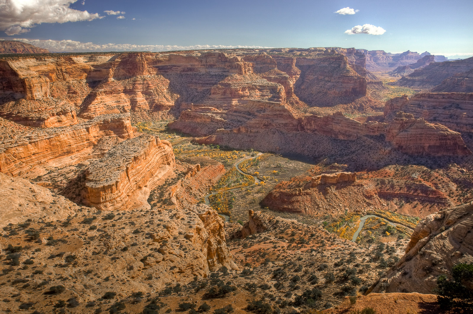
The Wedge Overlook is perhaps the single most dramatic viewpoint in Emery County. The access road climbs through rolling pinyon-juniper woodland and ends without warning at the canyon rim — and there, more than 1,200 feet below, the San Rafael River winds between sheer sandstone walls in a canyon locally called Utah’s Little Grand Canyon. The overlook requires no hiking. The canyon itself can be explored on a 14-mile trail that follows the river, a relatively flat walk given the dramatic surroundings.
Buckhorn Wash
Buckhorn Wash is a north-south corridor through the Swell’s northern reaches. Several features make it worth a full day:
- Buckhorn Wash Pictograph Panel: Located 3.5 miles north of the swinging bridge, along the main road. Dozens of figures painted in the Barrier Canyon style more than 2,000 years ago — elongated anthropomorphs in ghostly earth tones. One of the most significant and accessible rock art panels in central Utah. Do not touch the pigment.
- Buckhorn Dinosaur Track: A dinosaur trackway accessible near the wash road.
- Buckhorn Swinging Bridge: A historic pedestrian suspension bridge over the San Rafael River; still crossable by foot.
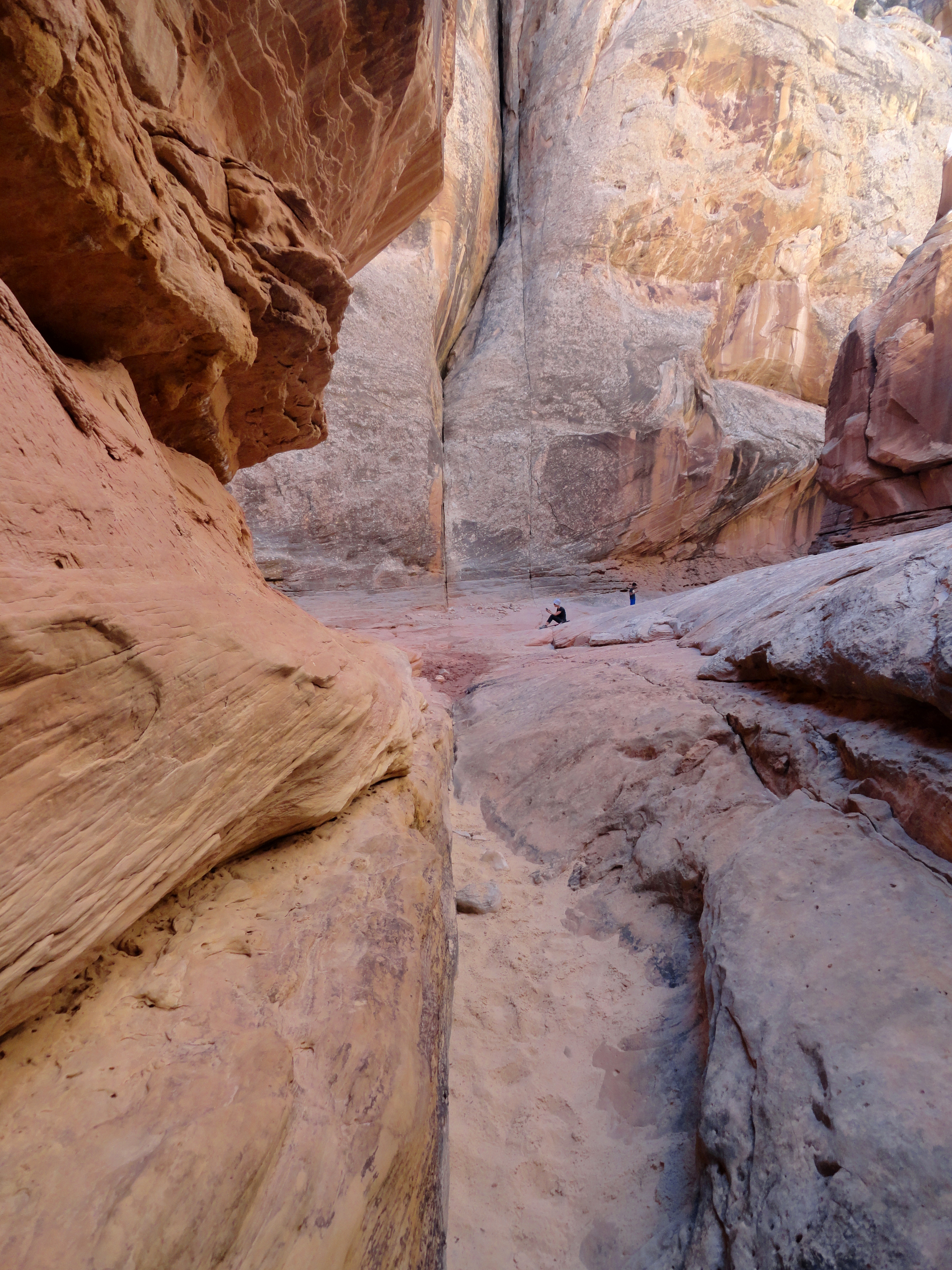
- Furniture Draw: A non-technical slot canyon suitable for casual explorers, including families with older children.
- MK Tunnels: A remnant of Cold War-era explosive testing conducted by the Martin Marietta Corporation in the 1950s — two tunnels bored into the canyon wall, now abandoned and open for inspection. A strange and fascinating piece of industrial history embedded in an ancient landscape.
Temple Mountain
Temple Mountain (6,798 ft) anchors the southern approach to the Swell. The peak itself is a technical day-climb for experienced scramblers. The surrounding area is threaded with roads left by mid-twentieth-century uranium and vanadium mining operations, making it excellent ground for exploration by high-clearance vehicle. The BLM has designated these roads into a recognized network under the 2026 Travel Management Plan.
Black Dragon Canyon
Black Dragon Canyon, accessible from the I-70 corridor, contains a pictograph panel whose clustered figures have long been interpreted — fancifully — as a dragon in flight. The canyon itself is a short hike from the highway and offers a good introduction to the Swell’s canyon character without requiring a full day.
The Buckhorn Draw Day Loop
Rock art, a 1937 suspension bridge, and a 1,200-foot canyon view — all in one dirt-road day from Castle Dale.
On the ground
Stop at the Buckhorn Wash Pictograph Panel (3.5 miles past the swinging bridge) to spend time with 2,000-year-old Barrier Canyon figures. Walk across the 1937 CCC swinging bridge over the San Rafael River. Continue to the Wedge Overlook for lunch at the canyon rim — 1,200 feet below, the river bends through Utah's Little Grand Canyon. Canyon walls are prime raptor habitat; scan with binoculars in the morning light. Return via the same road, or exit south to I-70 for a loop route back to Castle Dale.
See also: Chapter 12 (Rock Art) · Chapter 2 (Deep-Time Geology)
30.3 Slot Canyons
Slot canyons form where water finds a crack in flat-lying or gently tilted sandstone and begins to cut downward faster than it cuts sideways. Over thousands of years, the crack deepens into a passageway that can be hundreds of feet tall and barely wide enough for a human body. The light inside changes by the minute. The walls are smooth and scalloped where floods have polished them for centuries.
The San Rafael Swell contains dozens of named and unnamed slot canyons. Two have become the standard introduction to the form.
Little Wild Horse Canyon and Bell Canyon Loop
Located in the San Rafael Swell roughly ten minutes by dirt road from Goblin Valley State Park, this 8.1-mile loop combines two slot canyons into a single circuit. The hike takes most parties four to six hours (the trailhead sign advises allowing the full six for parties with children or slower pace). No technical climbing gear is required, though there are sections of easy scrambling — lifting yourself over a pour-off, squeezing through a narrowing — that add to the experience rather than presenting genuine obstacles.
Access: From UT-24, turn west on Temple Mountain Road (signed for Goblin Valley). Continue past the Goblin Valley turnoff to the Little Wild Horse Trailhead. The final approach is dirt road; most vehicles manage in dry conditions.
The loop: Most hikers enter Little Wild Horse Canyon first (the northern canyon) and exit via Bell Canyon (the southern return). Little Wild Horse is the narrower and more dramatic of the two — the walls press close and the light goes strange. Bell Canyon is broader but still beautiful. The two connect through a short section of open wash.
Flash flood warning: This is not a theoretical hazard. Flash floods in slot canyons kill people every year in southern Utah. Before entering, check the weather forecast not just for your location but for the entire upstream drainage — thunderstorms 20 miles away can send a wall of water through a clear-skied canyon with no warning. If the sky looks threatening anywhere on the horizon, do not enter. If you are inside and hear a roaring sound or notice the water in the canyon suddenly turning muddy, move immediately to the highest available ground.
Furniture Draw
A non-technical slot canyon accessible from the Buckhorn Wash road in the northern Swell. Shorter and gentler than Little Wild Horse, Furniture Draw is a good option for families with younger children or for visitors who want a slot canyon experience without committing to a full-day hike.
Other Canyons
The Utah Geological Survey has documented numerous additional slot canyons throughout the Swell. Many are unmarked and require navigation skills, route-finding experience, and sometimes technical canyoneering equipment. They represent a deep inventory of exploration for experienced visitors.
Slot Canyon Science
- □ A place where you can touch both canyon walls at the same time — the narrowest passage in the narrows
- □ A pothole: a round depression worn into the canyon floor by swirling water and sand over centuries
- □ A flute: a curved groove carved into the canyon wall where flood water cut a channel
- □ Bonus — a chockstone: a boulder wedged between the canyon walls by a past flood
Share your finds! #EmeryEncyclopedia
30.4 Goblin Valley State Park
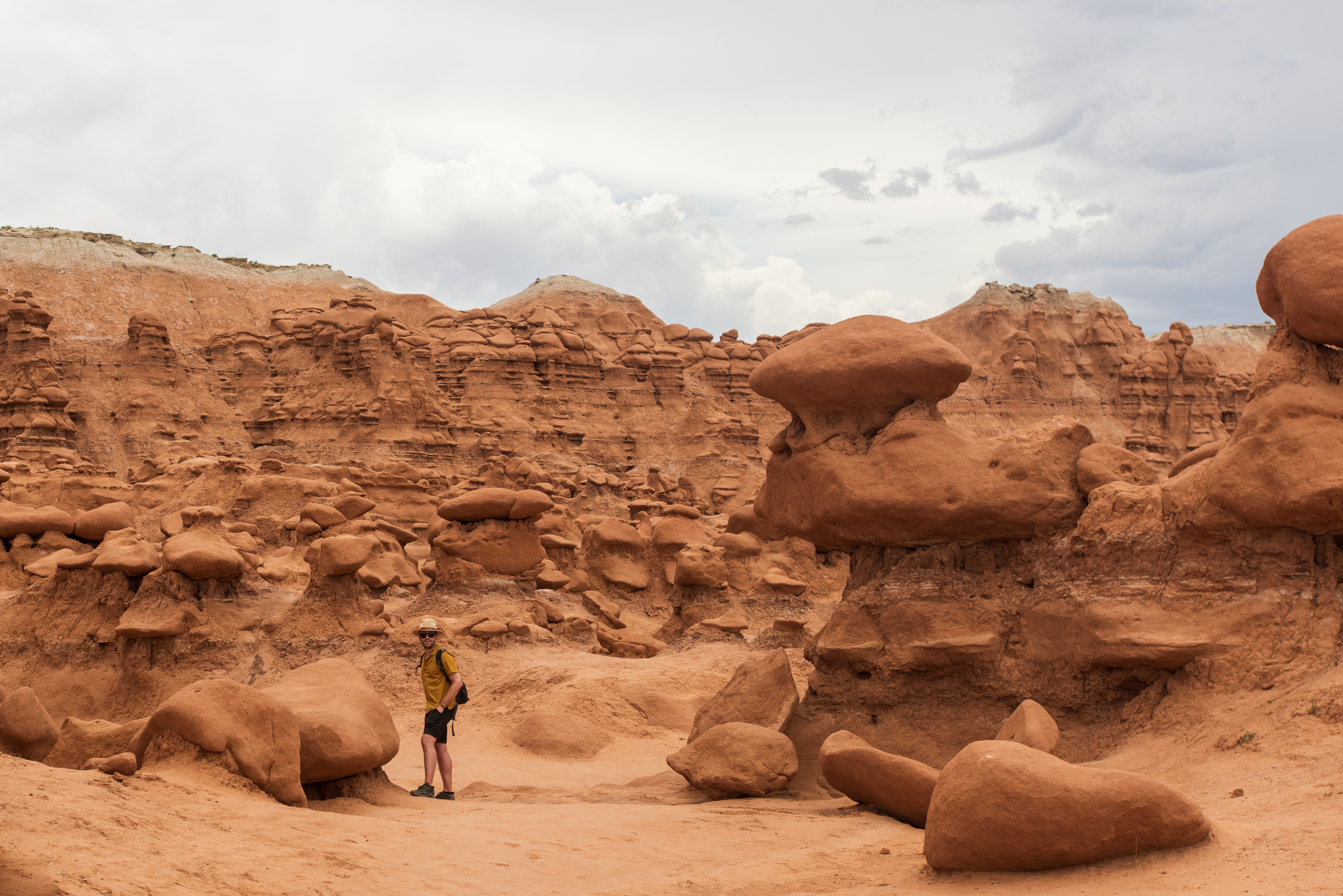
Goblin Valley occupies a broad depression in the southern edge of the San Rafael Swell where erosion has worked on the Entrada Sandstone in an unusually even way, producing thousands of rounded, mushroom-shaped hoodoos — the “goblins” — scattered across the valley floor. They range from knee-height to twice a person’s height and cluster in groups that invite the imagination. Children tend to react to Goblin Valley the way adults react to large cathedrals: with an immediate, spontaneous recognition that something significant is happening here.
Visitor Logistics
- Location: 15 minutes north of Hanksville on a signed road off UT-24; approximately 1 hour from Castle Dale via I-70 and UT-24.
- Entry fee: $20/vehicle/day (up to 8 passengers); $10 for motorcycles and bicycles. Check stateparks.utah.gov for current rates and any senior/resident discounts. No cell service at the park or on the access road.
- Hours: Visitor Center open daily 6 a.m.–10 p.m.
- Reservation: No reservation required for day use; camping ($45/night, includes one vehicle entry) and yurts ($150+tax/night) require advance booking (see §30.9).
What to Do
The valley floor is open to unrestricted wandering among the goblins — there are no designated trails through the main valley. Visitors are welcome to climb on the formations (the sandstone is soft; be gentle and do not damage formations by jumping on narrow caps). A dozen marked trails on the valley rim range from easy to moderate, 1–4 miles roundtrip, with views over the goblin field and into the broader Swell.
Goblin Valley is a certified International Dark Sky Park, which means light pollution is minimal and the night sky is extraordinary. If you are camping at the park, plan to stay up past midnight at least once.
An 18-hole disc golf course operates within the campground — free with park entry.
Geology Note
The goblins are eroded from the Entrada Sandstone, a Middle Jurassic formation (roughly 170 million years old) that was deposited as coastal dunes and tidal flats. The same formation contains the reservoirs of the region’s oil and natural gas fields and, in different form, the slot canyons of Little Wild Horse. Here, a combination of uniform composition and sparse vegetation allowed erosion to work evenly across the formation, producing the goblin field rather than deep slot canyons. See Chapter 2 (Deep-Time Geology) for fuller treatment.
Goblin Valley Explorer Challenge
Give each person a different goblin shape to find and photograph — a mushroom, a toadstool, an elephant, a face in the rock. The valley floor has no designated trails; everyone scatters freely. Set a meeting point at the main overlook platform and a time limit, then let everyone explore. Reconvene and compare photos. Discussion questions: Why do all the goblins have round caps? What made the softer rock underneath disappear? The 18-hole disc golf course in the campground area is a bonus for families staying overnight.
What you'll need:
Camera or smartphone, Sun hat, Water
Goblin Valley State Park appeared in Galaxy Quest (1999) as the surface of an alien planet — a fitting role for a landscape so genuinely strange that visitors regularly describe it as looking like it belongs on another world. The goblins are eroded from Middle Jurassic Entrada Sandstone deposited roughly 170 million years ago, long before any life on Earth would have recognized a coastline, let alone a film crew.
30.5 Rock Climbing and Bouldering
Joe’s Valley, in the western part of Emery County near Orangeville, is one of the world’s great bouldering destinations. This is not local boosterism. Climbers fly from Europe, Japan, and Australia to spend a season on the sandstone boulders scattered through the valley. The guidebook to Joe’s Valley documents more than 1,100 distinct boulder problems across 188 sites connected by 9.7 miles of social trail. An estimated 15,000 climbers visit each year. Joe’s Valley Fest, an annual climbing festival, draws competitors and spectators from across the world.
Why Joe’s Valley?
The sandstone here has an unusual combination of properties: it is coarse enough to provide friction, hard enough to hold holds without crumbling, and shaped by erosion into an extraordinary variety of problem types. The landings are generally clean. The elevation (roughly 6,500–7,000 feet) keeps summer temperatures tolerable when the desert below is brutal. And the problems span the full range of difficulty — from moderate routes accessible to recreational climbers to some of the hardest established problems in the world.
The Three Main Areas
- Left Fork: The most visited zone, containing many of Joe’s most famous classic problems.
- Right Fork: Slightly less trafficked; high-quality problems across all grades.
- New Joe’s: Developed more recently; continues to yield new problems as exploration continues.
Practical Notes
- Season: Spring (March–May) and fall (September–November) are ideal. Summer is manageable at this elevation but hot midday. Winter is possible on sunny days but some areas become wet and unusable.
- Access: From Orangeville, take UT-29 west toward Joe’s Valley Reservoir. The bouldering areas are signed off the reservoir road.
- Camping: Dispersed BLM camping is available in the valley; the Joe’s Valley Reservoir campground (USFS) provides a developed option (note: closed April 13–June 10, 2026 for construction; verify status before visiting).
- Leave No Trace: The climbing community has established trail systems to reduce social trailing damage. Use designated paths between boulders.
- Information: Mountain Project (mountainproject.com) and the Joe’s Valley Fest website (joesvalley.org) maintain current route information and access news.
Joe's Valley bouldering problems are graded from V0 — manageable for a motivated first-timer — to V14, among the hardest grades recorded anywhere in the sport. Elite climbers fly from Europe, Japan, and Australia to attempt the hardest problems; families with no climbing experience routinely find routes they can top in an afternoon. Very few places in the world can honestly make both claims.
30.6 Off-Highway Vehicle and Backcountry Routes
The San Rafael Swell has long been a destination for OHV enthusiasts, and the 2026 BLM Travel Management Plan formalized nearly 1,500 miles of designated routes across the Swell — one of the largest OHV route networks on BLM land in Utah. This clarification of legal routes is significant: visitors can now navigate with confidence that they are on designated roads rather than inadvertently crossing into sensitive areas.
Key OHV Corridors
- Coal Wash (North and South Forks): Designated open routes through the heart of the Swell; mix of sandy wash travel and rocky terrain.
- Devil’s Racetrack: The name describes the experience — a challenging route over rough ground requiring a vehicle with genuine clearance and skid plates. Not for first-time off-roaders.
- Justensen Flat: A more accessible designated area suitable for a wider range of OHV types.
- Mexican Mountain Area: Remote and rugged terrain in the northern Swell; requires serious 4WD capability and navigation skills. Emery County has long advocated for expanded access here; check current route designations with the BLM Price Field Office.
- Arapeen OHV System: Located on the Wasatch Plateau west of Joe’s Valley Reservoir; more than 350 miles of designated trails suitable for all skill levels, from easy forest roads to technical mountain routes.
Self-Sufficiency Is Not Optional
In the San Rafael Swell, you are responsible for your own recovery. There is no tow service in the backcountry. Cell service is absent. A stuck or broken-down vehicle can mean a very long walk or an expensive helicopter rescue. Before any backcountry OHV trip:
- Carry tow straps, a hi-lift jack, a full-size spare, and basic tools.
- Know how to use them.
- File a trip plan with someone who will call for help if you do not return by a set time.
- Carry a satellite communicator (Garmin inReach, SPOT, or equivalent).
- Download offline maps (Gaia GPS or similar) before losing cell service.
30.7 River Running and Water Recreation
The Green River
The Green River forms the eastern boundary of Emery County and offers two distinct multi-day river trips — one gentle, one serious — both of exceptional scenic quality.
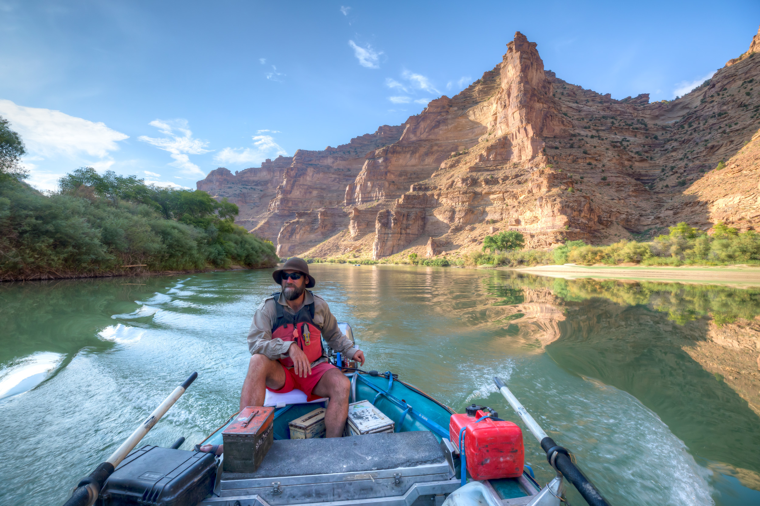
Labyrinth Canyon is the easier option: flat water, no rapids, suitable for canoes, kayaks, and rafts of all types. The typical launch is at Green River State Park in the town of Green River; the takeout is at Mineral Bottom, approximately 68 river miles downstream. A free permit is required and available from BLM (download at blm.gov and email to blm_ut_labyrinth@blm.gov; BLM Moab Field Office: 435-259-2100). The season runs spring through mid-fall. This is a multi-day trip — most parties plan three to five days. The canyon walls rise steadily as you travel downstream, and the solitude deepens with each mile.
Desolation and Gray Canyons constitute one of the great river trips in the American West: 84 miles through one of the deepest roadless canyons in the lower 48 states, with dramatic cliff scenery, ancient rock art, and abundant wildlife. The character is fundamentally different from Labyrinth — Class III–IV rapids in Desolation require solid whitewater skills and experience. A lottery permit is required for launches between May 1 and September 30 (applications accepted December 1–January 31 for the following year’s season). Outside the lottery window, permits are available first-come, first-served. Fees: $6 reservation fee plus $40 per person. Contact the BLM Price Field Office (435-636-3600) for current information.
Both trips require complete self-sufficiency: all water must be treated or carried, waste packed out, and no outside resupply is available. Shuttle logistics require leaving a vehicle at the takeout or arranging a commercial shuttle.
Green River: Two Trips, Two Experiences
| Labyrinth Canyon | Desolation / Gray Canyons | |
|---|---|---|
| Distance | 68 miles | 84 miles |
| Difficulty | Flat water — canoe, kayak, or raft | Class III–IV rapids — experienced paddlers only |
| Permit | Free BLM permit (email blm_ut_labyrinth@blm.gov) | Lottery, $40/person — apply Dec 1–Jan 31 |
| Season | Spring through mid-fall | May 1–Sep 30 (lottery); shoulder season walk-up |
| Days | 3–5 | 5–7 |
| Atmosphere | Remote silence; canyon walls deepen each day | One of the deepest roadless canyons in the lower 48 |
Both trips require complete self-sufficiency: carry all water, pack out all waste, no outside resupply. Shuttle logistics require a vehicle at the takeout or a commercial shuttle service.
Joe’s Valley Reservoir
At 1,170 acres and 7,000 feet elevation, Joe’s Valley Reservoir is the recreational hub of the Wasatch Plateau. Fishing is the primary draw — the reservoir is designated a Blue Ribbon fishery, with excellent populations of rainbow trout, cutthroat trout, splake, and trophy tiger muskie. Ice fishing in winter is outstanding. The boat ramp accommodates motorized and non-motorized craft; water skiing and wakeboarding are permitted. The reservoir also serves as a base camp for bouldering (a 10-minute drive), Arapeen OHV riding (trailhead just west of the reservoir), and hiking into the surrounding Manti-La Sal National Forest.
2026 note: The Joes Valley Campground is closed April 13–June 10, 2026 for construction. Confirm status at recreation.gov before planning a visit during this period.
30.8 Overlooks and Scenic Drives
Not all of Emery County’s rewards require physical effort. Several drives and viewpoints deliver spectacular scenery from a vehicle window or a short walk from a parking area.
Wedge Overlook (The Little Grand Canyon): Reached via a dirt road from Castle Dale (roughly 20 miles). The overlook stands at the canyon rim, 1,200+ feet above the San Rafael River. No hiking required; bring a camp chair and stay for sunset. The view extends across miles of canyon country.
Buckhorn Draw Scenic Backway: The 40-mile dirt road from Castle Dale to I-70 through the heart of the northern Swell. Stops include the pictograph panel, the swinging bridge, the dinosaur trackway, and multiple pullouts with canyon views. Plan four to six hours including stops. The road is graded dirt — high-clearance recommended but passenger cars have made it in dry conditions. Inquire with the BLM Price Field Office after any significant rain.
Temple Mountain Road: From I-70 Exit 149 north toward Goblin Valley, the road passes through classic Swell scenery — buttes, fins, exposed color-banded cliffs — before reaching the Goblin Valley turnoff. Continuing past the turnoff leads toward Temple Mountain and the uranium country roads.
South Skyline Drive: A high-elevation route along the Wasatch Plateau, accessible from several canyon-road ascents. Views extend east across the full breadth of the San Rafael Swell and west into the Sanpete Valley.
The Buckhorn Draw Swinging Bridge was built by the Civilian Conservation Corps in 1937 to allow cattle crossings of the San Rafael River — at the time, the only bridge over the river for miles in either direction. Cattle were driven across it seasonally for decades. It is now a historical landmark that hikers walk across for the experience of a suspension bridge over a canyon, nearly ninety years after the last cattle drive used it for the same purpose.
30.9 Camping and Base Camps
Emery County offers a spectrum from primitive desert camping under an unobstructed Milky Way to a yurt with a swamp cooler.
Dispersed BLM Camping (San Rafael Swell): The default option for most backcountry visitors. Dispersed camping — setting up camp on public land away from designated sites — is permitted on most BLM land in the Swell except in posted closures or within 200 feet of water sources. No fee; no reservation. Bring everything you need, including all water. Pack out all waste. There are no fire rings, and fire danger in the desert is extreme — check current fire restrictions before building a fire.
Buckhorn Draw Campground (BLM): A basic developed campground in the Buckhorn Wash area; provides a more organized base for exploring the northern Swell. Reservation available at recreation.gov.
San Rafael Swinging Bridge Campground (BLM): Small campground near the historic bridge; convenient for access to Buckhorn Wash features.
Goblin Valley State Park Campground: 24 sites (10 walk-in tent pads, 14 RV spaces) plus 2 yurts and a group site. Reservation required; $45/night includes one vehicle entry pass. Yurts are $150+tax/night and are furnished with beds, a futon, heat, and a swamp cooler — the most comfortable sleeping option in the area. Book well in advance, particularly for spring and fall weekends.
Green River State Park: In the town of Green River; full hookups and showers available; convenient for river trips launching from Green River. Also serves as a base camp for exploring the eastern Swell.
Joes Valley Campground (USFS): Developed campground at Joe’s Valley Reservoir with lake views, vault toilets, and water. Fee required. Note 2026 closure (April 13–June 10) for construction.
30.10 Safety and Preparedness
The landscapes of Emery County are genuinely remote. The following is not a liability disclaimer — it is practical information that experienced desert travelers take seriously.
Water: The desert kills through dehydration faster than through any other mechanism. The San Rafael Swell has no reliable water sources. Carry a minimum of one gallon per person per day; two gallons in summer. Do not plan to find water in canyons or washes — springs are unreliable and sources that appear on old maps may be dry or contaminated.
Flash Floods: The most dangerous hazard in slot canyons and narrow washes. Flash floods can occur under blue skies when storms are falling miles away, upstream in the drainage. Warning signs: a rumbling or roaring sound; water suddenly turning muddy or rising; debris moving downstream. If you observe any of these, move immediately to high ground. Check weather forecasts for the entire upstream drainage before entering any canyon, and monitor the sky constantly while inside.
Cell Service: Effectively absent throughout the San Rafael Swell, Goblin Valley corridor, and most backcountry areas. Do not plan to call for help using a cell phone. A satellite communicator (Garmin inReach, SPOT, or similar) is strongly recommended for any trip beyond the main paved or graded roads.
Heat: Summer temperatures in the Swell routinely exceed 100°F (38°C). Hike early — before 10 a.m. — or not at all in peak summer. Goblin Valley in June has no shade on the valley floor. The Wasatch Plateau at 7,000–11,000 feet is significantly cooler and may be the better summer destination.
Navigation: GPS and offline maps (Gaia GPS, onX, or CalTopo) are essential for backcountry OHV and hiking trips. Download maps before leaving cell service. Paper backup maps are always a good idea — electronic devices fail.
Vehicle Self-Rescue: High-clearance vehicles should carry: full-size spare, tow strap, hi-lift jack, air compressor (for airing down tires on sandy terrain and re-inflating before returning to pavement), and basic tools. A second vehicle traveling with you in remote areas multiplies safety significantly.
Permits: Required for Green River multi-day trips (see §30.7). No permit required for day hiking in the Swell or Goblin Valley day use (standard entry fee applies).
30.11 Seasonal Access Guide
| Season | Highlights | Cautions |
|---|---|---|
| Spring (Mar–May) | Ideal for Swell hiking, slot canyons, Joe’s Valley bouldering, Green River trips, Goblin Valley. Wildflowers in April–May. | Flash flood risk increases with spring storms. Dirt roads can be impassable after rain. Goblin Valley crowded on spring break weekends. |
| Summer (Jun–Aug) | Wasatch Plateau (Joe’s Valley area) is the best destination — elevation provides relief. Joe’s Valley Reservoir fishing and water recreation. | Extreme heat in the Swell and Goblin Valley (100°F+). Afternoon thunderstorms increase flash flood risk. Hike only before 10 a.m. in low-elevation desert. |
| Fall (Sep–Nov) | Peak season for almost everything. Joe’s Valley bouldering at its best. San Rafael Swell hiking and scenic drives. Green River trips. Cooler temperatures throughout. | Days shorten; plan multi-day trips accordingly. Early snowfall possible in October on the Wasatch Plateau. |
| Winter (Dec–Feb) | Ice fishing at Joe’s Valley Reservoir (often excellent). Snowshoeing and cross-country skiing on the Wasatch Plateau. Swell slot canyons can be cold but uncrowded. | Some dirt roads in the Swell become impassable. Goblin Valley visitor center may have reduced hours. High-clearance 4WD with snow tires advisable for Wasatch Plateau access. |
30.12 Field-Guide Summary Table
| Destination | Type | Primary Access | Vehicle Req. | Best Season | Permit? |
|---|---|---|---|---|---|
| Wedge Overlook / Little Grand Canyon | Scenic overlook, hiking | Emery Co. Rd. 332 from Castle Dale | High-clearance rec. | Spring, Fall | No |
| Buckhorn Wash | Scenic drive, rock art, history | Emery Co. Rd. 332 | High-clearance rec. | Spring, Fall | No |
| Temple Mountain | OHV, scrambling | I-70 Exit 149 → Temple Mtn. Rd. | High-clearance rec. | Spring, Fall | No |
| Black Dragon Canyon | Rock art, short hike | I-70 Exit 175 area | 2WD | Year-round | No |
| Little Wild Horse / Bell Canyon Loop | Slot canyon hike | Temple Mtn. Rd. to LWH trailhead | 2WD (dry) | Spring, Fall | No |
| Furniture Draw | Slot canyon (easy) | Buckhorn Draw Rd. | High-clearance | Spring, Fall | No |
| Goblin Valley State Park | Scenic, hiking, camping | UT-24 → Goblin Valley Rd. | 2WD | Spring, Fall | Day fee ($15) |
| Joe’s Valley Bouldering | Rock climbing / bouldering | UT-29 west from Orangeville | 2WD | Spring, Fall | No |
| Joe’s Valley Reservoir | Fishing, boating, camping | UT-29 west from Orangeville | 2WD | Summer, Winter | No (camping fee) |
| Labyrinth Canyon (Green River) | Flat-water paddling (multi-day) | Green River State Park launch | 2WD | Spring, Fall | Free BLM permit |
| Desolation / Gray Canyons (Green River) | Whitewater paddling (multi-day) | Sand Wash launch | 2WD | Spring–Fall | Lottery permit ($40/person) |
| Coal Wash / Devil’s Racetrack | OHV routes | Multiple I-70 exits | High-clearance 4WD | Spring, Fall | No |
| Arapeen OHV System | OHV, mountain biking | Joe’s Valley Reservoir trailhead | 2WD to trailhead | Summer, Fall | No |
Sources
Primary/Government Sources
- Bureau of Land Management — San Rafael Swell Recreation Area: https://www.blm.gov/visit/san-rafael-swell-recreation-area
- Bureau of Land Management — Little Wild Horse Trailhead: https://www.blm.gov/visit/little-wild-horse-trailhead
- Bureau of Land Management — Joe’s Valley Bouldering Area: https://www.blm.gov/visit/joes-valley-bouldering-area
- Bureau of Land Management — Labyrinth Canyon River: https://www.blm.gov/visit/labyrinth-canyon-river
- Bureau of Land Management — Desolation/Gray River Permit: https://www.blm.gov/visit/desolation-gray-green-river-permit
- Bureau of Land Management — Buckhorn Draw Campground: https://www.recreation.gov/camping/campgrounds/10283369
- Bureau of Land Management — Behind the Reef Trail: https://www.blm.gov/visit/behind-reef-trail
- Utah State Parks — Goblin Valley: https://stateparks.utah.gov/parks/goblin-valley/
- USDA Forest Service — Joes Valley Reservoir, Manti-La Sal National Forest: https://www.fs.usda.gov/r04/manti-lasal/recreation/joes-valley-reservoir
- Utah Division of Wildlife Resources — Fish Utah (Joes Valley Blue Ribbon): https://dwrapps.utah.gov/fishing/?NA=Joes+Valley+Reservoir+(Blue+Ribbon)
- Utah Geological Survey — Slot Canyons of the San Rafael Swell, Emery County: https://geology.utah.gov/map-pub/survey-notes/geosights/geosights-slot-canyons-of-the-san-rafael-swell-emery-county/
- Utah Geological Survey — Little Grand Canyon, Wedge Overlook, and Buckhorn Draw Scenic Backway: https://geology.utah.gov/map-pub/survey-notes/geosights/little-grand-canyon/
- Emery County Sheriff — Search and Rescue Safety Tips: https://emery.utah.gov/home/offices/sheriff/sar/safety-tips-resources/
- Recreation.gov — Desolation/Gray Canyon Permit: https://www.recreation.gov/permits/233393
Secondary and Travel Sources
- Visit Utah — San Rafael Swell: https://www.visitutah.com/places-to-go/parks-outdoors/san-rafael-swell
- Visit Utah — Goblin Valley: https://www.visitutah.com/places-to-go/parks-outdoors/goblin-valley
- Visit Utah — Grand Tour of the San Rafael Swell: https://www.visitutah.com/articles/a-grand-tour-of-the-san-rafael-swell
- Visit Emery County — Joe’s Valley Bouldering: https://visitemerycounty.com/joes-valley-bouldering
- Visit Emery County — Joe’s Valley Reservoir: https://visitemerycounty.com/joes-valley-reservoir
- Visit Emery County — Little Wild Horse Canyon: https://visitemerycounty.com/little-wild-horse-canyon
- AllTrails — Little Wild Horse / Bell Canyon Trail: https://www.alltrails.com/trail/us/utah/little-wild-horse-bell-canyon-trail
- Mountain Project — Joe’s Valley Bouldering: https://www.mountainproject.com/area/105880382/joes-valley
- Joe’s Valley Fest — Guide to Joe’s Valley: https://joesvalley.org/guide-to-joes-valley
- Utah.com — Joe’s Valley Bouldering Guide: https://www.utah.com/articles/post/joes-valley-bouldering-guide/
- Travel and Tour World — 2026 BLM Travel Management Plan: https://www.travelandtourworld.com/news/article/utahs-san-rafael-swell-unveils-new-travel-plan-with-nearly-1500-miles-of-designated-routes-massive-boost-for-adventure-tourism-in-2026/
- RiverBent — Desolation Canyon: https://riverbent.com/running-the-green-river-through-desolation-canyon-in-utah/
Proposed Maps and Figures
-
Map 30-A: Emery County Adventure Overview — County-wide map showing three terrain zones (Wasatch Plateau, San Rafael Swell, Green River corridor) with key destinations labeled and color-coded by activity type. Should include major road access routes (I-70, UT-24, UT-29, Emery Co. Rd. 332).
-
Map 30-B: San Rafael Swell Recreation Areas — Detailed map of the Swell showing: Wedge Overlook, Buckhorn Wash road corridor, Temple Mountain, Black Dragon Canyon, Little Wild Horse Trailhead, Goblin Valley access road, I-70 exits, and major designated OHV routes from the 2026 Travel Management Plan.
-
Map 30-C: Joe’s Valley Area — Map showing Joe’s Valley Reservoir, bouldering area access roads (Left Fork, Right Fork, New Joe’s), Arapeen OHV trailhead, and route from Orangeville on UT-29.
-
Figure 30-D: Little Wild Horse / Bell Canyon Loop Diagram — Simple schematic of the 8.1-mile loop showing entry/exit canyon names, key landmarks (scrambling sections, canyon width extremes), and trailhead location relative to Goblin Valley.
-
Figure 30-E: Green River Trip Segments — Linear diagram of the Green River through Emery County showing Labyrinth Canyon (Green River State Park to Mineral Bottom) and Desolation/Gray Canyons (Sand Wash to Nefertiti/Swaseys), with mileage markers and permit zones indicated.
Proposed Tables
-
Table 30.12 (Field-Guide Summary) — See §30.12 above. This is the chapter’s primary reference table; it should be printed on a facing-page spread if layout permits, and replicated as a digital quick-reference card with QR-code link.
-
Table 30-B: Green River Trip Comparison — Side-by-side comparison of Labyrinth Canyon vs. Desolation/Gray Canyons covering: distance, difficulty, permit type, cost, season, skill requirements, and contact information.
-
Table 30-C: Seasonal Temperature and Conditions — Month-by-month summary for each terrain zone (Plateau, Swell, River corridor) showing average high/low temperatures, typical conditions, and access notes. [Requires data from Ch04 — Climate & Weather; coordinate with that chapter during revision.]
Three Zones, One County
- Your subject
- One photograph per terrain zone — Wasatch Plateau, San Rafael Swell, and Green River corridor — all captured on a single trip
- Where to find it
- What to look for
- The story you're telling
- The central claim of this chapter's opening paragraph is that Emery County contains multitudes: high-mountain spruce forest, desert slot canyon, and river wilderness — all within a one-hour drive of each other. This photo challenge asks you to hold all three in a single frame of mind and document the contrast.
Share your photo with #EmeryEncyclopedia